Physical aspects of the country

Physical aspects of the country

Paraguay is a landlocked country, located between latitudes 19º and 27º south and longitudes 54º and 72º west of Greenwich. The Tropic of Capricorn crosses the country, which covers a total area of 406,752 km2. The Paraguay River divides the country into two regions:

Paraguay Occidental

Paraguay Oriental

también conocido como el Chaco; es una vasta planicie dividida en dos áreas: El Alto y Bajo Chaco. El Alto Chaco es ligeramente más elevado que el Bajo Chaco y es reconocido por sus sabanas y lagunas naturales rodeadas de bosques y vegetación espinosa. El Bajo Chaco está bordeado por los ríos Paraguay y Pilcomayo, está casi al nivel del mar, y está cubierto por interminables palmares. La mayoría de los habitantes del Chaco viven en el ésta seguna área debido al clima, régimen de lluvias y tipo de suelo, y en las Colonias establecidas en parte del Chaco Central.

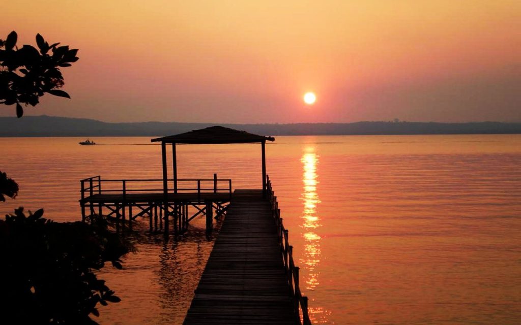
El Paraguay Oriental se presenta al visitante con una topografía completamente diferente. Posee bosques tropicales y semi-tropicales, intercalados con campos de pastos altos y bajas colinas con un máximo de 850 metros de altura. Su elevación lentamente aumenta hacia la frontera brasileña y está regada por numerosos ríos. Hay dos lagos importantes: el lago Ypoa y el conocido lago Ypacaraí. Es la región más poblada del país y donde se encuentran las ciudades más importantes.

Western Paraguay

Also known as El Chaco; It is a vast plain divided into two areas: The Alto and Bajo Chaco. The Alto Chaco is slightly higher than the Bajo Chaco and is renowned for its natural savannas and lagoons surrounded by forests and thorny vegetation. The Bajo Chaco is bordered by the Paraguay and Pilcomayo rivers, is almost at sea level, and is covered by endless palm groves. The majority of the inhabitants of the Chaco live in this second area due to the climate, rainfall regime and type of soil, and in the Colonies established in part of the Central Chaco.

Eastern Paraguay

Presents itself to the visitor with a completely different topography. It has tropical and semi-tropical forests,interleaved with fields of high pastures and low hills with a maximum of 850 meters in height. Its elevation slowly increases towards the Brazilian border and is watered by numerous rivers. There are two important lakes: Lago Ypoa and the well-known Lago Ypacaraí. It is the most populated region of the country and where the most important cities are located.


Rivers

The Paraná and Paraguay Rivers, originated in Brazil, are the largest and most important waterways in the country.

The Paraná River is approximately 4,500 km long and its course is interrupted by the most powerful hydroelectric dam in the world: Itaipu, located in the Yguazú area, on the border with Brazil. Another hydroelectric dam, located 400 km down on the same river, on the border with Argentina, is the Yacyreta.
Both rivers reach the Río de la Plata or the delta of the Río de la Plata and then flow into the Atlantic Ocean off the coast of Uruguay.

The Paraguay River is 2600 km long and is navigable almost entirely from north to south.

The Pilcomayo River originates in the Bolivian Andes, until the confluence with the Paraguay River. This river forms a natural border with Argentina, to the west.Other important rivers are: the Tebicuary, which is only 235 km long and ends when it meets the Paraguay River and the Confuso River, which runs almost parallel to the Pilcomayo and is 280 km long.

Mountain Ranges
(cordilleras)

In Eastern Paraguay there are several mountain ranges of considerable importance:

– Cordillera del Amambay, with the highest peak of 700 meters, is located in the National Park of Cerro Corá, in Pedro Juan Caballero.
– Cordillera del Mbaracayú, 120 km long, forms a natural border between Paraguay and Brazil.
– Cordillera de Caaguazú, located in the middle of the country, near the Cordillera del Ybytyruzú.

The villages of Altos, Caacupé, Piribebuy and Paraguarí are located in the Cordillera de Altos.

These towns are important because of their contribution in craft work and in the history of the countryLa Colmena, La Rosada (former iron foundry) and Parque Nacional de Ybycuí are also located in the Cordillera de Altos.

Plants

Undoubtedly, the most important and lasting impression of a visit to Paraguay is the explosion of colors caused by the native flora, in the interior of the country and in the city of Asunción. A green and humid forest covers a large part of the country and the most common trees are:

The yellow Ybyrapyta, which blooms during the summer and autumn.

The Petereby and the Guayca. The blue Jakaranda and Red Flamboyant complete the symphony of colors blooming in the Spring.
Flowers like jasmine, white and orange mango flowers, hibiscus, acacias, Mburucuja flower and orchids are common in Paraguay, offering a natural scent to wildlife.Yerba mate is a native shrub that grows wild. Its green leaves are dried and crushed to prepare the traditional “tereré”, a national drink that is taken with ice water during the summer and with hot water during the winter.

Animals

The Paraguayan fauna is concentrated in the semi-tropical and savanna areas. Mentioning the most common species, from an endless list:

Mammals: wild pig, collared peccary, tapir, cougar or american lion, jaguar, coati, armadillo and capuchin monkey.

Fish: surubí, dorado and pacú